Satellite Images Show the Mother of All Bombs' Devastating Impact
Not so much caves as an entire town.

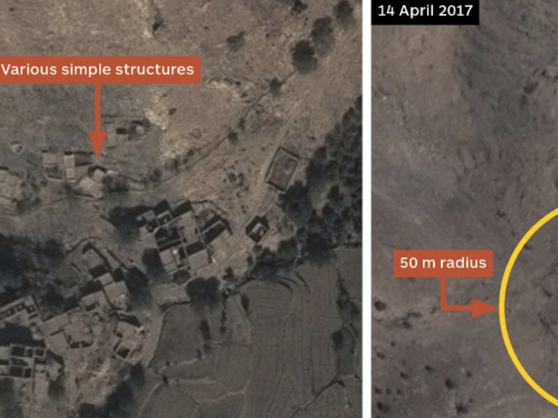
Recently released satellite images have pinpointed the location of a massive airstrike on April 13, when the U.S. Air Force dropped a GBU-43/B Massive Ordnance Air Blast, aka the Mother of All Bombs, for the first time in active combat.
The first satellite images of the target, sourced from Airbus Defense and Space’s imaging services, appeared on Twitter on Thursday. The Mother of All Bombs, or MOAB, is the most powerful non-nuclear weapon in the U.S. military’s arsenal, and until last week had never been used in combat.
The MOAB is a thermobaric weapon that kills and destroys with its massive blast wave of compressed gases, which reportedly can extend up to a mile from the blast site. The satellite images show the ISIS-controlled compound in November of last year, before the strike, and on April 14, the day after the strike, and the damage is shocking.
It looks like the target, described as a network of tunnels, caves, and buildings, was a small village-sized area possibly containing entrances to an underground network. U.S. officials said the network was filled with booby traps and improvised explosive devices, which the government said justified the use of the MOAB, despite the fact that the military had other, more precise options. In the after image, the compound of buildings is completely leveled.
“This is the first time we have encountered an extensive obstacle to our progress that was constituted by I.E.D.s, the presence of tunnels and caves, and therefore this was the appropriate weapon to use at this time,” Gen. John W. Nicholson Jr., the commander of American and NATO forces in Afghanistan, said at a news conference in Kabul on April 14.
“It was the right time to use [the Mother of All Bombs] tactically against the right target on the battlefield, and it has enabled us to resume our offensive operations,” Nicholson said.
You can also see the compound before the strike on Terraserver’s satellite imaging service. Google Maps hasn’t imaged the site in high enough resolution to properly make out the area, but you can see the strike’s location in the greater context of Afghanistan there.