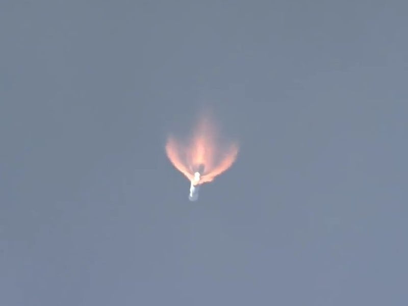
This has undoubtedly been a crazy week. Luckily, United Launch Alliance (ULA) provided the distraction we all needed: a rocket launch. Following a nearly two-month delay for technical and wildfire-related issues, a ULA Atlas V rocket lifted off at 1:30 p.m. Eastern on Friday from California’s Vandenberg Air Force Base.
Launching from complex 3, the 194-foot-tall rocket ferried a sophisticated commercial imaging satellite — dubbed WorldView-4 — into orbit. Operated by DigitalGlobe, the satellite is toting a camera powerful enough to resolve objects as small as 1-foot-wide from a distance of 383 miles.
The satellite — which is roughly the same size as a Chevy Suburban — can image nearly 263,000 square miles each day, and will join three other WorldView satellites already in orbit. Together, the quartet can view a single location 4.5 times per day.
WorldView-1 captured the launch of WorldView-3 in 2014.
In order to capture these incredible images, WorldView-4 will be parked in a sun-synchronous orbit — meaning it will orbit the Earth from pole to pole — which allows the satellite to travel over the same location at the same time each day.
WorldView-4 was originally scheduled to launch on September 16, but was delayed when crews detected a minor fuel leak. Two days later, a second scrub was called due to the threat of wildfires running rampant just south of the Air Force base. The fires took about a week to contain, and luckily the pad was unharmed. However, power and communications systems at the base did sustain some minor damage, which has taken a few weeks to repair.
Artist rendition of the WorldView-4 satellite looking at the Earth.
Today’s flight marks the 9th this year for ULA — which is a joint venture between Lockheed Martin and Boeing — and the 112th flight since the aerospace company formed in 2006. The rocket used on today’s flight was originally intended to ferry NASA’s InSight mission to Mars, which has now been moved to 2018.
WorldView-4’s main customer will be the U.S. government, however, foreign governments, intelligence agencies, and specific commercial customers (who have permission from the U.S.), will be able to purchase the data and observing time.
The satellite relies on the Global Positioning System (GPS) network as well as onboard star trackers to determine its precise location relative to what it’s observing. With the satellite, DigitalGlobe clients will be able to image specific targets, large areas, or long, narrow strips of land. Customers will also be able to capture before and after imagery, which will come in handy during a crisis or natural disaster.
Artist rendition of the WorldView-4 satellite in space.
“High-resolution commercial satellite imagery plays a critical role in modern society, from helping to keep nations safe, to supporting disaster response efforts, to powering a wide range of location-enabled applications and services. We are proud to support the launch of WorldView-4 and its sophisticated technology, which millions of commercial users throughout the world will rely upon for years to come,” Eileen Drake, president and CEO of Aerojet Rocketdyne — who provided the rocket’s upper stage — explained in a news release.
ULA’s motto is to save lives, explore the universe and protect our world. By serving as DigitalGlobe’s ride to space, they are enabling the satellites to change lives here on Earth in ways no one expected. In July 2015, WorldView-4’s sister satellite, WorldView-3, helped shut down a human trafficking ring in the South Pacific.
High-resolution imagery from the satellite provided the smoking gun needed to identify a fleet of fishing boats that relied on slave labor. The slave boats shared their catches with commercial fishing vessels, who turned off their locator beacons during the illegal exchanges.
DigitalGlobe wants everyone to see a better world.
AP reporter Martha Mendoza provided DigitalGlobe with a region near Papua New Guinea to search for fishing vessels who were involved in slave labor rings. Within 24-hours, the WorldView-3 satellite had beamed back images of the Silver Sea 2 fishing vessel attached to two slave labor ships. In the captured images, the vessel is shown with cargo holds open, waiting to receive the slave-caught payload.
“DigitalGlobe provided the evidence, the smoking gun, with high-resolution imagery that was able to uniquely identify the fishing boats involved,” Walter Scott, DigitalGlobe’s founder, said at the Space 2.0 conference in Milpitas, California earlier this year. “The net result was a series of arrests, unrolling a slaving operation, freeing 2,000 slaves and reuniting them with their families.”
The WorldView-3 satellite captured views of a commercial fishing vessel accepting salve-caught cargo.
In addition to WorldView-4, the rocket ferried seven cubesats into orbit as part of a rideshare mission — dubbed ENTERPRISE — which was sponsored by the National Reconnaissance Office.
