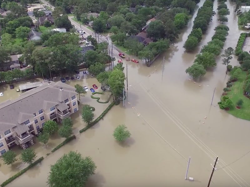
Drone Videos Offer a New View of Houston Flood Devastation
The crisis is clear.

Houston is just beginning to emerge from some of its worst flooding in recent memory, but thanks to the images from citizens across the area who flew drones throughout the ordeal, the entire country can see just how much work remains to be done clearing land and rebuilding.
At least seven people are dead, and Cypress Creek, which began to overflow after heavy rains just two days ago, still hasn’t crested, leaving the city bracing for another day of danger.
On Monday, the Houston area found itself hit by rains that dropped as much as 17 inches in one 24-hour period. The flooding has become so severe that statistically it should occur only once every 200 years, according to the University of Oklahoma and the National Oceanic and Atmospheric Administration. Cypress Creek has risen more than five feet over flood levels, and the water has destroyed at least 1,000 homes, caused billions of dollars in damages and drowned seven people in their cars.
The Houston flooding has wrecked entire neighborhoods, a fact made clear when viewed from above. Drone footage over the course of the three-day event has shown the water’s progression.
Mark Katz took advantage of a brief break in the rain on Monday to capture the flood at its worst:
Other drone owners have managed to send up their drones several times over the course of the flood to give a sense of how the flooding has affected certain areas. YouTube user Kate P. uploaded a series of flights centered around Cutten and Cypresswood that show the change in water levels and property damage. This video was the scene on Monday:
Kate sent the drone up again on Tuesday and captured the same neighborhood. She lives in the Meyerland area that has been the focus of the flooding and the scene of at least four of the deaths. The water has clearly risen in some areas, and the scene is one of post-apocalyptic solitude:
The drone images capture the uniformity of the damage across wide stretches of the area. This next video focuses on a more affluent community that wasn’t able to avoid the drenching. While the manicured lawns appear untouched, the streets and what appears to be a golf course nearby are totally submerged:
Finally, William Stevenson juxtaposed shots of the flooded area taken before the flooding and after it. For those wondering how a body of water like the Cypress Creek could cause mass flooding, this video shows just how crazy it is that the glorified stream had to contend with several feet of rain. It’s a good reminder that much of Texas is desert, and even temperate regions sometimes don’t see this quantity of rain for months at a time.
The response to the Texas-sized tragedy has proven languid at best, meaning drone videos don’t necessarily incite a more effective emergency response. But they did help spread the word to the rest of the world that the situation in Meyerland reached crisis levels. They’re stark, but they are also hopeful, reminding us that each of the houses we see from above, though an island, contain a family ready to start rebuilding and getting on with their lives.