Iceland’s Volcano On Reykjanes Peninsula Finally Erupts — Here’s What It Looks Like Now
Icelandic meteorologists were concerned that an eruption near the fishing town of Grindavik was imminent.

For weeks, Iceland was on the cusp of a major volcanic eruption. It’s finally begun, and you can keep an eye on the situation through these live feeds.
Icelandic meteorologists were concerned that an eruption near the fishing town of Grindavik was imminent. The Reykjanes peninsula of southwestern Iceland experienced more than 10,000 earthquakes, with magnitudes of 2.7 to 4.5, from October 24 to November 14, 2023. The tremors, plus satellite data that shows ongoing land deformation, were a sign last month that magma might be rising toward the surface.
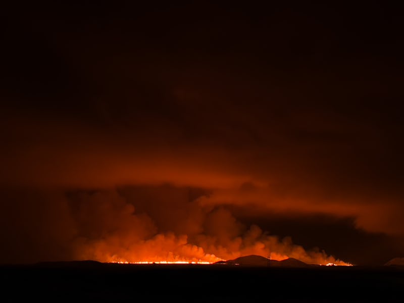
The eruption finally happened, and the footage is dramatic.
When did the volcanic eruption in Iceland start?
On Monday, Iceland’s Coast Guard took incredible imagery of the lava spewing up from below the ground.
Þorvaldur Þórðarson, a volcanologist, told Icelandic news outlet RÚV English that he guesses that the highest eruptive jets are about a hundred meters high.
It began after a swarm of earthquakes erupted near Grindavik around 4:00 p.m. Eastern Time, or 9:00 p.m. local time in Iceland. According to the Icelandic Meteorological Office, the eruption began shortly thereafter, at 10:17 p.m. local time.
Iceland is no stranger to volcanic activity. But the developments over the last two months are particularly compelling.
Is this rare for Iceland?
Iceland is no stranger to volcanic activity. But the developments over the last two months are particularly compelling.
Seismic data suggests magma had been lingering four to five kilometers below the surface near Þorbjörn mountain. “Models show that the extent of the magma tunnel is significant and magma is approaching the surface,” according to an update that the Icelandic Meteorological Office published November 11.
“It can be concluded that there is a significant chance that magma will manage to break its way to the surface. There is also an increased chance that magma can emerge on the ocean floor,” officials added.
Seismic activity had a relative slowdown. But what that means is still up for interpretation. The broadcasters on Tuesday’s episode of RÚV English Radio, which was taped around 1:00 pm local time on November 14, said it was hard to tell what caused the slowdown. It might have been a sign that there wouldn’t be an eruption after all or that the system was gearing up for one in the days to follow.
Roads entering Grindavik were closed, and its nearly 4,000 inhabitants evacuated.
On November 12, the Icelandic Meteorological Office reported that sensors had detected increased levels of sulfur dioxide (SO2). The source of the elevated levels of the gas was uncertain, SÚV reported, but it could have been a sign that magma was very high in the Earth’s crust.
“SO2 is not released from magma until very close to the surface. It just means the top kilometer,” Benedikt Ófeigsson, a geophysicist at the Icelandic Meteorological Office, told SÚV. “It's not possible to tell the depth directly, but it [the magma] must be very shallow for us to see SO2,” Ófeigsson added.
How long will it last?
Live From Iceland shows webcam livestreams from around the country. The Svartsengi channel shows a feed from Þorbjörn mountain.
Two RÚV webstreams are currently operating from the peninsula, and the news agency has plans to add more cameras.
The RÚV liveblog and the Icelandic Meteorological Office’s X account are other ways to get steady, local updates on the volcanic eruption that might be just on the horizon.
This article was originally published on