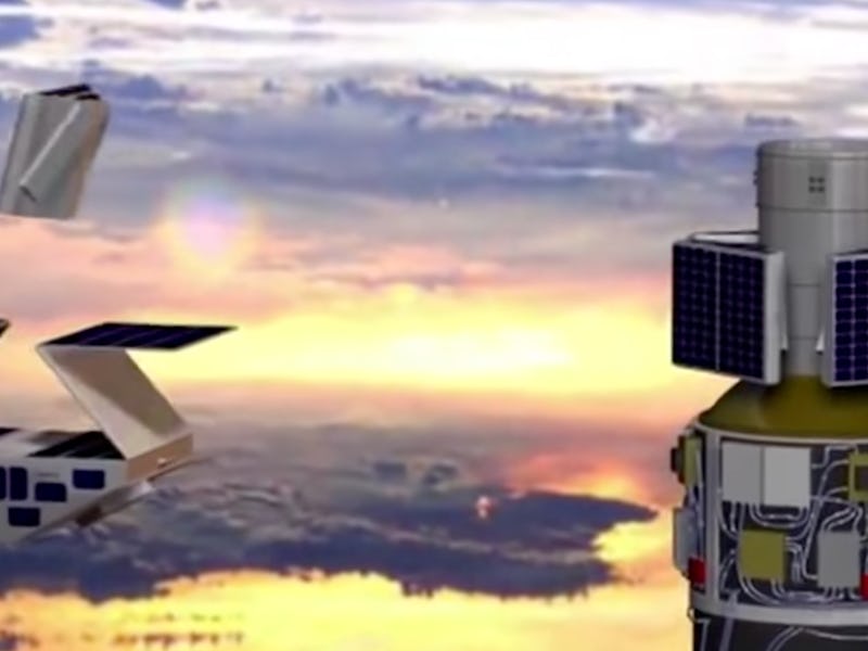
Hurricanes are one of nature’s deadliest phenomena, but we’re about to learn a lot more about them, which could save scores of lives and teach us even more about these massive storms.
It’s all thanks to NASA’s eight microsatellites that will help scientists track how hurricanes evolve over the Earth’s oceans. The fleet, dubbed Cyclone Global Navigation Satellite System (CYGNSS), is designed to measure the wind speeds inside hurricanes and tropical cyclones. It’s scheduled to launch on December 12 from Kennedy Space Center in Cape Canaveral, Florida.
Each CYGNSS satellite is no larger than a carry-on suitcase and weighs 64 pounds. Individually, the satellites can only provide scientists with updates every few days, but together, they can beam back crucial data every few hours.
“We’re doing real science with a spacecraft that can literally sit on your desk,” John Scherrer, CYGNSS’s project manager at the Southwest Research Institute in San Antonio, told reporters on Thursday. “Not just one of them, but eight — they’ll be orbiting in the tropics where the hurricanes are, and every 90 minutes they’ll be making another measurement.”
A single CYGNSS satellite
The CYGNSS system is able to perform crucial science with a small price tag, coming in at $162 million to build and run. Previous hurricane missions measured wind speeds over the ocean using wavelengths of light that were short, which unfortunately could be scattered by rain drops. These tools were limited in what the data they could collect, and were unable to collect sufficient data in the inner core where the rainfall was the heaviest. Also, hurricanes evolve very rapidly, so swarms of satellites working together collect better data faster.
“Today, we can’t see what’s happening under the rain,” Chris Ruf, professor in the University of Michigan’s Department of Climate and Space Sciences and Engineering and principal investigator for the CYGNSS mission, explained. “We can measure the wind outside of the storm cell with present systems. But there’s a gap in our knowledge of cyclone processes in the critical eye wall region of the storm — a gap that will be filled by the CYGNSS data.”
Here's how CYGNSS measures hurricane winds.
CYGNSS works in tandem with orbiting GPS satellites by measuring specular reflection — aka mirror reflection. GPS transmitters operate at longer wavelengths, which means that raindrops won’t be able to thwart CYGNSS science abilities. When the GPS signals are released, they bounce off the oceans below and CYGNSS then records the data. How the signals reflect tells the satellites how rough or smooth the ocean is and a storm’s wind speed can be determined from that. Each satellite measures the reflections from four spots simultaneously as they orbit over the tropics.
With a constellation of eight satellites, that’s equivalent to the work of 32 hurricane hunting airplanes, the researchers said. The satellites will operate for at least two years, and will re-measure any given spot every seven hours.
The microsatellites will launch on a Pegasus rocket made by Virginia-based Orbital ATK and they will be dropped from an L-1011 aircraft at 40,000 feet. Just five seconds later, the rocket engines will ignite and carry it and the payload into space. The satellites will then be released in opposite pairs, every 30 seconds, until all eight are separated. The solar arrays will deploy approximately ten minutes later, and the satellites will get to work, beaming their data down to ground stations in Hawaii, Chile, and Australia.
“CYGNSS is a tool that will provide us 24/7 coverage of the tropical cyclone zone, and it will improve our knowledge of how hurricanes grow so that we can better prepare and protect the people in the path of each hurricane as it comes,” said Christine Bonniksen, CYGNSS program executive with the Science Mission Directorate’s Earth Science Division at NASA Headquarters. “We came in on schedule, on cost, and on science.”
Predicting where hurricanes will strike is no easy feat. Current forecasting errors are half as frequent as they were 20 years ago, thanks to missions like CYGNSS. “Earth science saves lives,” Thomas Zurbuchen, associate administrator for NASA’s Science Mission Directorate at the agency’s headquarters in Washington said during the press conference. “CYGNSS will improve our ability to understand and predict how these deadly storms develop.”
